
On the ground
- Access
- Nearest railway station: Dimapur Railway Station (DMV).
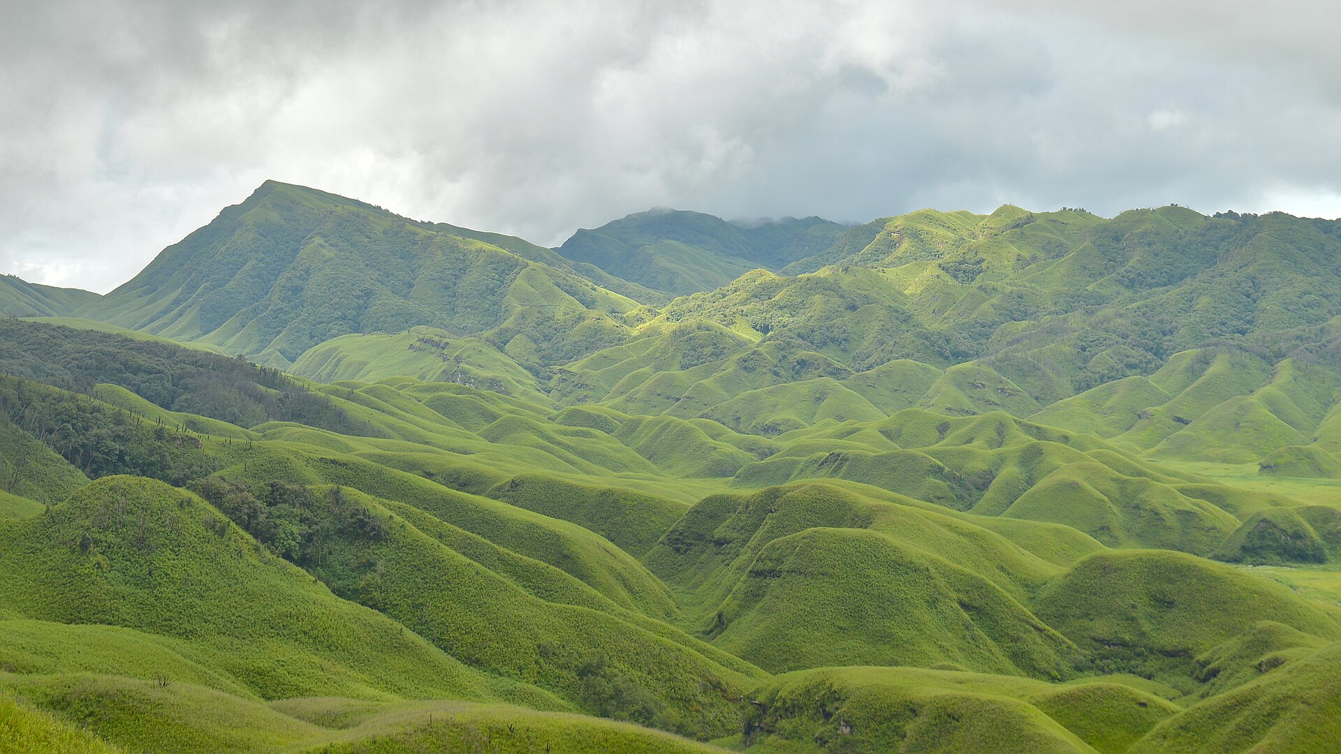
Photo: Original: Samudra Bikash Hazarika · CC BY-SA 4.0 · Wikimedia Commons
Sign in to save places and plan trips, day by day.
Dzukou Valley lies on the border of Nagaland and Manipur at about 8,045 feet (2,452 m), south of Kohima. Its rolling grassy knolls and folds give it an unusual landscape, and in early July the slopes fill with wildflowers, the best known being the Dzukou lily. One story links the name to a failed attempt by Viswema villagers to farm here, the word meaning dull or barren; another reads it as cold water, after the chilly stream that runs through the valley.
The walk in is about 9 km and takes five to six hours over steep, often slippery forest paths. From the Nagaland side there are two approaches: the well-used Viswema route, where a jeep covers the first stretch, and the shorter but steeper Jakhama route with thousands of steps. A newer path from Mount Tempu in Manipur's Senapati district enters from the other side. Hiring a local guide is advised on every route.
Unmapia
Coming soon
We’re still writing about Dzukou Valley: its history, what’s there and why it’s worth the trip.
Where it is
No map pin yet: directions search for the name