 Nature & Wildlife
Pookode Lake
A forest-fringed lake offers an easy pause among Wayanad’s hill roads.
Famous · Wayanad
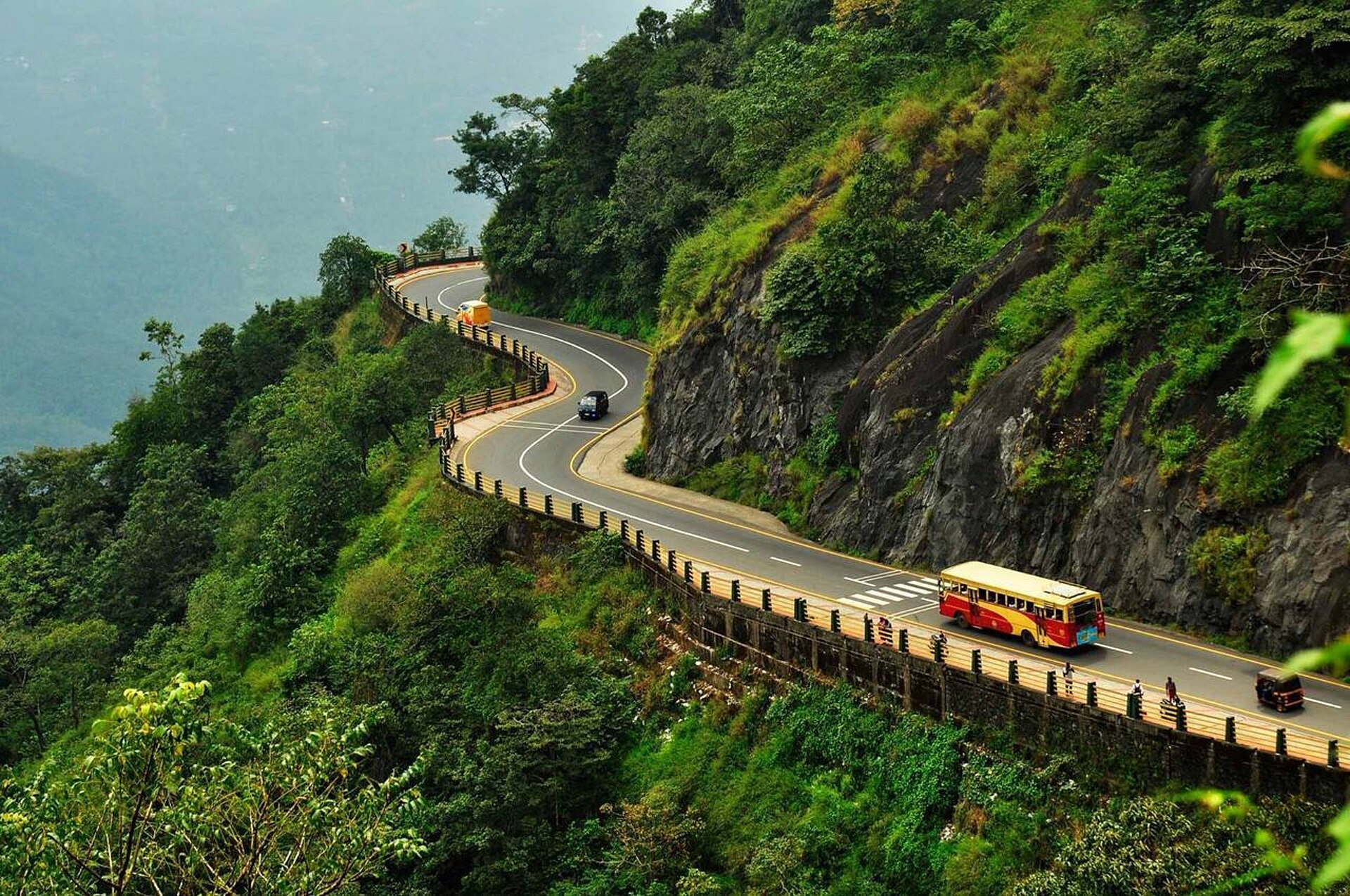
Photo: Keerikkadanjose · CC BY-SA 4.0 · Wikimedia Commons
Sign in to save places and plan trips, day by day.
Thamarassery Churam is the mountain pass that carries National Highway 766 over the Western Ghats between Kozhikode and Wayanad districts; churam is Malayalam for a pass. The pass lies around 800 m above sea level, and the road runs for about 14 km from Adivaram up to Lakkidi Viewpoint, turning through nine hairpin bends, and the area around it is known for coffee plantations, waterfalls and hilltop views.
The route has a story. Between 1700 and 1750 the British, who sent spices from Wayanad to Beypore port by the Kuttiadi route, looked for a shorter way down and were guided along this one by Karinthandan Moopan, a Paniya chief. He is believed to have been shot afterwards, and legend says his ghost troubled travellers until a sorcerer nailed it to a tree. That tree, the chain tree, stands at Lakkidi, 1 km from the Churam viewpoint.
Unmapia
Coming soon
We’re still writing about Thamarassery Churam: its history, what’s there and why it’s worth the trip.
Where it is
11.50° N 76.02° E