 Nature & Wildlife
Miao and Namdapha gateway
A small town is the threshold to one of India’s wildest forests.
Offbeat · Changlang
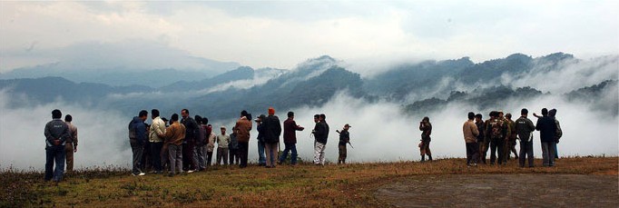
Photo: Arif Siddiqui · CC BY 2.5 · Wikimedia Commons
Sign in to save places and plan trips, day by day.
Pangsau Pass sits at 1,136 metres along the top of the Patkai range, on the border between Arunachal Pradesh and Myanmar, and takes its name from Pangsau, a Burmese village 2 km beyond it. It is one of the easiest ways from the Assam plains into Burma. British surveyors studied it in the late 19th century for a railway to Myitkyina that was never built.
The pass became famous during the Second World War, when General Joseph Stilwell's engineers drove the Ledo Road through it to supply Chinese forces fighting Japan. The 61 km route from Ledo passed Jairampur and Nampong before climbing steeply through forest to the crest; the mud and gradients earned it the nickname Hell Pass. Since 2007 the Pangsau Pass Winter Festival has been held at Nampong each January, three days of folk music, dances, crafts and food from Northeast India and Myanmar, including Tangsa traditions.
Unmapia
Coming soon
We’re still writing about Pangsau Pass: its history, what’s there and why it’s worth the trip.
Where it is
27.23° N 96.15° E